DOTD to conduct LiDAR scanning on I-20/I-220 in Bossier Parish
Tuesday, May 29, 2018 at 9:02:31 AM
DOTD to conduct LiDAR scanning on I-20/I-220 in Bossier Parish
The Louisiana Department of Transportation and Development announces the use of LiDAR scanning as part of the I-20/I-220 Barksdale Air Force Base (BAFB) Interchange project in Bossier Parish.
The scan is set for the morning of Thursday, May 31, 2018 on a section of I-20 and I-220, and is a method used to complete survey work for the environmental portion of the project.
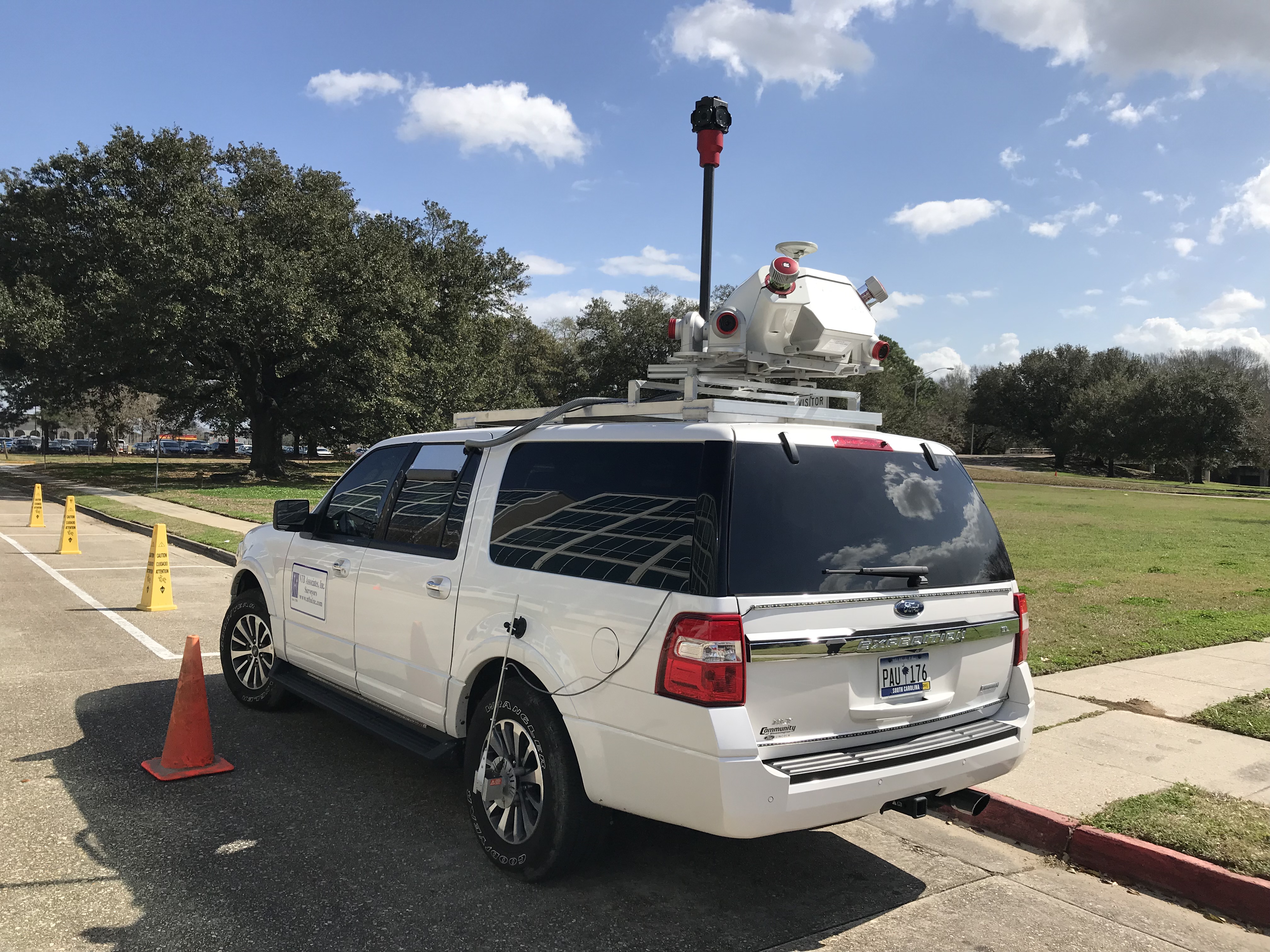
Crews will be traveling along I-20 eastbound and westbound, as well as I-220 in the vicinity of the interstate interchange, while the Mobile Light Detection and Ranging (LiDAR) vehicle travels accompanied by two Louisiana State Troopers. The LiDAR scan will also be utilized on the interstate ramps.
Because it is necessary to operate the LiDAR vehicle slowly, motorists may encounter a slow-down of traffic in this corridor similar to a funeral procession, though there will be no lane closures.
The LiDAR method is used to measure distance by utilizing laser lights that make digital 3-D representations of the intended target. This method is beneficial due to its cost-effective nature and minimal inconvenience to the traveling public. DOTD has used this technology in previous projects throughout the state, and it has been proven to be a useful tool in the Topography Survey Process.
Surveying work is weather dependent, and should take place from approximately 7 a.m. to 3 p.m., during non-peak travel times.
Motorists can access the latest updates on real-time traffic and road conditions by going to www.511la.org. You can also download the 511la.org app to your smartphone or use the 511 Traveler Information System by dialing 511 from your telephone and saying the route or region where you are seeking information. Out-of-state travelers can call 1-888-ROAD-511 (1-888-762-3511).